Many people look forward to the snowy, bright days of winter. In Wisconsin, the season is as enjoyable as it is unpredictable. There are many local and global factors influencing snowfall and temperatures across the state. Knowing the science behind winter weather can help people to understand the conditions seen in a typical season.
Understanding the Weather
Increase A. Lapham pioneered the modern methods used to understand and predict the weather in Wisconsin. A canal engineer and surveyor, he also had an interest in meteorology, and is considered the father of the National Weather Service. Lapham was concerned about Wisconsin farmers as well as the safety of Great Lakes maritime activities. In 1849, he began providing official weather reports to the Smithsonian Institute in Washington D.C. He petitioned a Milwaukee congressman about the importance of having a weather service, and eventually President Ulysses S. Grant signed a national weather service into law. Lapham assumed responsibility for the Great Lakes region in 1870, using the telegraph to send the reports, issuing a storm warning on his first day.
Today’s weather reporting is much more complex than in Lapham’s day. Where he analyzed weather systems using a barometer, barograph, and rain gauge, they are now created with the additional help of computers, radar, satellites, and modern communication methods. Because of this, scientists understand the workings of weather with a higher degree of accuracy.
The Earth and Sun
Winter, like all the seasons, is caused by the interaction of the earth’s orbit around the sun and the earth’s axial tilt. The orbit of the earth around the sun is elliptical, so the distance from the sun varies. The earth’s axis of rotation is also tilted 23.5 degrees. In January, the earth is actually closer to the sun. But due to the axial tilt, the northern hemisphere receives less direct sunlight than the southern, and for shorter periods. These are the main factors for cold winter weather in the north and for the two hemispheres having opposite seasons.
The seasons are measured in two ways: astronomical and meteorological. Astronomical seasons are based on the solstices and equinoxes, which are determined by the relationship between the earth and the sun. In the northern hemisphere, winter starts on approximately December 21, the day with the shortest period of daylight, which is called the winter solstice. Meteorological seasons are based on the three months of the year when the predominant weather condition is seen on the ground. This time period is what news weather reports are based on. In this system, winter begins on December 1 and lasts through February.
Local and Global Climate Patterns
Besides orbital distance and axial tilt, weather patterns are determined by temperature, latitude, air pressure, and proximity to water. Water cycle is key. Warm sun causes water to evaporate, which then condenses into clouds in the cold atmosphere. As clouds become heavy, they can no longer hold onto all that water, which we then see as rain, snow, ice, fog, and other precipitates.
The intensity of the winter season can be affected by local as well as global climate patterns. The presence of Lake Michigan has a profound influence on our local weather. Known as the “lake effect,” warm surface waters can increase snow volume in near-shore communities during some winter snow events, as clouds continually replenish.
Global weather phenomena can have as much of an effect as local systems. The polar vortex is a system of cold, dry air that circulates around the poles. The vortex has always existed, and this cold, polar air is generally locked in the arctic. But weather events become more extreme with the warming of the planet. Because of warmer temperatures and the melting of the polar ice caps, this icy air isn’t held at the poles and drops into regions within the earth’s mid latitudes, such as in Wisconsin. The warming of the planet doesn’t always mean hotter temperatures!
Climate Patterns from the Pacific Ocean
Another climate pattern of note is called El Nino. In El Nino events, eastern trade winds that blow water toward Asia are weaker, allowing warmer surface water to build up on the west coast of the U.S. With this shift, the Pacific jet stream moves south of its neutral position. The jet stream is a band of strong wind in the upper atmosphere that follows the boundary of warm and cold air. When the Pacific jet stream moves south of neutral, it causes the Northern U.S. and Canada to be warmer and dryer and the south to be wetter.
A pattern called La Nina works opposite of El Nino. In La Nina events, trade winds blow Pacific Ocean water from the coast of Chile towards Asia. These winds are stronger than usual and blow more of the warm surface water out, pulling up, or upwelling, cold water from below the surface. This cold, nutrient rich water sits off the west coast of the U.S. and pushes the jet stream northward. This brings warmer temperatures and drought to the south and colder, wetter weather to the northern U.S. Adding complexity, the Pacific Ocean’s surface waters become warmer with the planet’s rise in temperature.
Clouds and Snowflakes
To know weather patterns that affect your area, look to the clouds, as they are the carriers of precipitation. There are three main categories of cloud formations: cirrus, cumulus, and stratus clouds. Cirrus clouds are found high up in the atmosphere and are dryer than the others. They are not as responsible for snow or other precipitation. Cumulus clouds, often large and billowy, sit in the mid-level atmosphere. When updrafts fill them with moisture and they grow, they are often responsible for precipitation. Stratus clouds are usually large, low-level clouds that indicate precipitation when gray. The heaviest snow often falls from altostratus clouds. These dense clouds, full of ice and water droplets, often appear to cover the whole sky.
The precipitation from clouds in winter falls in the form of ice crystals. These ice crystals adhere mostly to a six-sided hexagonal shape, which is the structure of ice. There are variations in snow crystals, but it is a myth that no two snowflakes are alike. The shape of a snowflake is determined by temperature and the amount of humidity. Moisture in clouds will attach to a dust particle, accumulating until it forms a drop. If the temperature is at or below 32 degrees, the water freezes, forming a snowflake.
Categories of Snowflakes
There are eight categories of snowflake crystals with 80 distinct shapes. These categories are needle, columnar, plate, a combination of plate and columnar, columnar with extended side planes, rimes snow crystal, irregular snow crystal, and the germ of crystal. In general, depending on water saturation, snowflakes from freezing down to 27 degrees F are thin and flat. Below that temperature to 18 degrees, they look like hollow columns, prisms, or needles. Down to -8 degrees, they become plate-like with branches. Below -8, they are plate-like or columnar. Colder weather produces smaller snowflakes, while warmer temperatures produce larger, wetter flakes.
Winter in Wisconsin
The coldest and snowiest Wisconsin locations are in Superior, Ashland, and Rhinelander, all northern cities. Snowfall in Wisconsin averages about 44 inched per season, but in February 2021, 22 inches of snow fell in just that month alone. There have been many other large snowfalls in Milwaukee’s history. During the Groundhog Day Blizzard in February of 2011, 19.6 inches of snow fell. These extremes demonstrate the variability of Wisconsin’s winter weather.
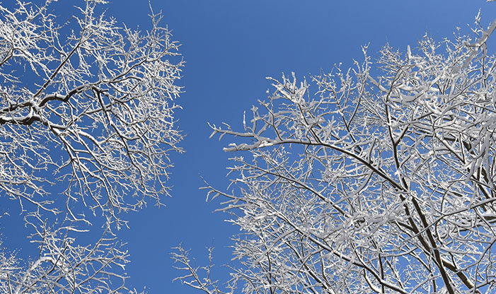
Despite the unpredictability of the weather, or perhaps because of it, winters of Schlitz Audubon are a wonder to experience. The amazing ice and snow formations on the shore of Lake Michigan, and the brilliant white, shining snow crystals that fall throughout our landscape are beautiful to observe. Knowing the science of winter weather makes it even more interesting. When you visit the Center, look to see the snow clinging to tree branches and be a witness to winter’s diversity.
Written with contributions from Tom Finley